Introducing 1UP Drones Construction Services – Elevating construction one Flight at a time!
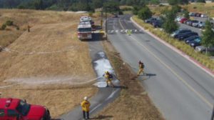
Drones are increasingly being utilized to provide topographical maps, scan large job sites, and create contour maps of terrain and structures with great accuracy.
Our drones enable construction professionals greater intelligence and site planning.
UAVs and aerial construction photography are quickly changing the practices of communicating on construction projects, BIM, and surveying land for building sites. Drones shorten a usually long process by producing 3D renderings of a property. 1UP believes the addressable market to be sizeable and estimates it to be $1.3bn in the US and $11.2bn worldwide, making Construction the largest Commercial end market for UAVs globally. UAVs offer a substantial cost-saving device for land surveying firms, construction companies, and aggressive collaboration is critical as surveyors are seasoned veterans with years of experience where precision is the life-blood.
Better, faster mapping complements survey teams with aerial surveying photogrammetry: UAVs will become a key tool for construction companies, surveyors, architects and engineers by allowing improved measurement accuracy and faster work. We find with proper Ground Control Points established that UAVs can have accuracy up to 6mm vs the ALTA standard maximum error of 20mm, so UAVs are more than 3X as accurate as the work demands, and UAVs can do the work in a fraction of the time. Popular Science reported that a drone could cut the surveying time for a 12-acre property from 100 hours down to about 2. 1UP which has partnered with the UAV SaaS company DroneDeploy, reports similar efficiency gains. The time savings will vary depending on the complexity of the terrain and task, but UAVs are well positioned to become critical tools for surveyors, construction companies, architects, and engineers alike. The ability of UAVs to quickly render detailed 3D models of terrain is game changing. High resolution cameras and data processors can analyze the landscape at 1mm per pixel.
Improved Communication and Construction Project Tracking with UAVs
Project Managers Use Drone Maps to Communicate with Stakeholders, Monitor Progress and More
More and more, project managers are finding drone mapping to be an indispensable tool during all phases of construction. Easy-to-use software allows 1UP to create high-resolution orthomosaic, elevation and 3D models in a matter of hours. Combined with built-in measurement tools and annotations, they keep real-time tabs on projects and identify potential issues before they become costly.
1UP Cloud-based maps make sharing and collaborating with everyone from site engineers to project owners simple. Executives and stakeholders stay informed and, because drone modeling is cost-effective, companies see a return-on-investment immediately.
Overlay Plans with High-Rez Models to Catch Conflicts ASAP
Land Developer, Charlie McKay uses drone models to manage large, custom developments, and monitor inventory of materials. He has been in construction for over fifty years. When he began incorporating drones into his work, he saw immediate savings of both time and money.
As the Developer on Candelas, a Master Planned community in Arvada, CO that was designed to combine the best of resort style amenities and the natural bounty found in Colorado our 1UP drones produced high-resolution maps that were overlaid with critical infrastructure and stockpile management. These overlays allowed Charlie to stay informed with real-time data, catch conflicts with services before they actually happened and redirect them at minimum cost.
Collaborate Virtually and Keep Stakeholders Informed
The construction company execs don’t feel the need to visit the site as often because with aerial drone photography they have a much better idea of how a site is progressing, says Jon Lee, Partner, Community Development Group.
Our surveyor working in conjunction with 1UP’s models and annotations feature allowed managers to convey information to multiple stakeholders with ease. Because maps are hosted in the cloud, it is easy to share information through email or a hyperlink. When a major land developer broke ground on a 200 acre site in Frederick, Colorado where the ground was not level, they used drone modeling, combined with 1UP’s measurement tools, to monitor the earth-moving process. The company worked with 1UP, to help them determine if 100,000 cubic yards of material could be properly scraped to an 85,000 cubic yard ditch.
Jon Lee, Partner, Community Development Group, points out that drone mapping greatly improves communication both onsite and off. It is the quickest way to keep surveyors, engineers, utility planners, and other stakeholders up to speed. The project managers, surveyors, architects, and engineers can much more formally and neatly be updated on the progress.
In addition to keeping management informed, the drone maps keep tabs on sites more efficiently. 1UP’s suite of high-resolution orthomosaic, 3-D and elevation models allows drill down into key sections of a site. Area, distance and volume measurement tools provide an additional level of detail.
A Cost-Effective Tool For Surveying
Michael Liedich uses drone models as a cost-effective alternative to traditional surveying. Leidich is President of Summit Brick, Pueblo, CO. In a matter of hours, 1UP created an elevation map to assess the topography of a quarry in which he had traditionally used fixed wing aircraft for material analysis.