While 2021 brought many new drones, software applications for drones, autonomous operations and the introduction of artificial intelligence into the drone workflow, there are many more enhancements that 2022 will bring. We anticipate autonomous workflows, artificial intelligence, public acceptance and ubiquitous operations are just over the horizon for the top drone mapping software applications available.
What’s Changed With Drones in the Last Decade?
Drones and drone operations have moved from being novel technology to acceptance into the mainstream. Where early drone usage caused minor eruptions in public privacy concerns and numerous misunderstandings, recent years have brought more acceptance and appreciation for drones’ many useful applications.
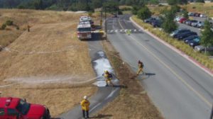
The COVID-19 pandemic left lingering repercussions all across the globe, one positive result was how it forced companies and organizations to become creative to remain relevant, and even solvent. Drones suddenly filled the gap in numerous industries like real estate, construction and development, insurance inspections, farming and agriculture, emergency management, rescue services and more. And, the top drone mapping software companies jumped to produce products to meet the demand.
What’s the Biggest Change to Come in 2022?
The biggest change coming in 2022 across the drone industry is advances toward autonomy in the mapping workflow. Automatic mobile uploads are the next big step in drone mapping software and operations, and some software manufacturers are already making great strides. Why is this important?
Consider the example of your smartphone. Remember your old flip phone that could do little but make calls and send simple text messages? Even the ability to take low-resolution photos was a massive step forward. But early phones required the user to remove the storage chip from the phone to transfer photos to a computer. Then, they could be uploaded to social media or shared with friends and family.
Jump back into today’s world where the modern smartphone is used in professional photography and even in some drone mapping applications, and hi-res images can be immediately sent to the cloud or shared elsewhere.
Current technology requires an operator to land the drone after programmed mapping is completed, remove the memory, plug it into a computer and then use the software to create the needed final deliverables. Soon, drone mapping operations, and other autonomous flights will benefit from removing some steps to that process with automatic mobile uploads.
Comparison of the Top Drone Mapping Software Applications
What are the top drone mapping software applications available today, and how do they compare to one another? Here’s a brief description of the ones we rate as the best.
DroneDeploy
DroneDeploy is a popular drone mapping software application that transforms images into high-resolution maps, plus includes simple-to-use tools for measuring elevation, area, distance, and volume. Drone operators program a flight path for their UAV, which then follows the course while recording high-resolution images. You are able to monitor the entire operation in real time, including important stats about the area being mapped and your drone’s health.
The software uses your recorded images to produce hi-res 2D maps and 3D models. DroneDeploy allows mobile uploading of your images to the DroneDeploy site. First, remove the storage from your drone and place it in your mobile device. The mobile device then uploads your images to DroneDeploy for rendering.
Pix4D
Pix4D offers a complete suite of drone mapping products for use in several industries, including agriculture, surveying, mining, inspections, emergency services and telecom. With cloud-based or server-based options, this platform is ideal for many commercial drone mapping applications. Uploading your images is simple, although it does require a few more steps than DroneDeploy.
Skydio 3D Scan
Skydio 3D Scan™ boasts to be a first-of-its-kind top drone mapping software, with automated data capture to make operations simpler. Enjoy incredibly detailed images used to create stunning quality 3D models and 2D maps. This software package is only usable with a Skydio brand drone.
Blue Marble Global Mapper
Global Mapper® by Blue Marble is the ultimate tool for professional drone mapping companies and users in various industries. Compatible with Google Earth and popular GPS tracking components, Global Mapper also reads and writes data from several of the most-used spatial databases. GIS professionals love Global Mapper and its many features.
UgCS
UgCS, now with an automatic LiDAR toolset, is a versatile mapping software that is also popular for planning drone light shows and multiple drone flight planning. Supported by several UAV platforms, this top drone mapping software has a terrain-following mode, live geotagged video stream, vertical scan and more to facilitate the most intricate mapping operations.
QGIS
QGIS is a great, user-friendly tool for beginners. As an Open Source Geographic Information System (GIS), it is licensed under the GNU General Public License. QGIS is an official project of the Open Source Geospatial Foundation (OSGeo). Compatible with Linux, Unix, Mac OSX, Windows and Android, it supports numerous vector, raster and database formats and functionalities. Developers and the user community provide a growing number of core plugins and functions to improve its capabilities. This is a great beginner tool to visualize, manage, edit, analyze data, and compose printable maps, but there are few tutorials and little support.
What are Some Other Hot Advancements to Expect in 2022 and Beyond?
Here’s some of the hottest new possibilities we’re watching closely at 1UP Drones:
- New power sources to enable longer flight times. Hydrogen is a notable example.
- New payload and sensor announcements, including the introduction of multispectral and thermal sensors.
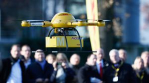
- An increase in drone delivery services for the public.
What about you? Are you interested in drone mapping or other drone operations? 1UP Drones provides superior training for professional drone users in a wide variety of industries. Contact us today for more information.