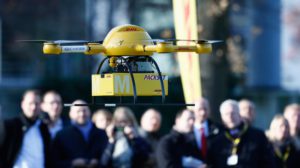
No matter the industry, UAV’s are changing the way companies do business. Our business gives your business a new perspective.
Next week is the largest UAV conference in the world and it happens to be in our backyard of Denver. AUVSI XPONENTIAL 2018 is the most comprehensive trade show for unmanned systems and robotics. It is truly the spot to find visionary insight, make new connections, and uncover next-generation unmanned vehicle development and ingenuity. We plan to be there and would be grateful if you joined us as our guest. Simply send us an email at Info@1UPDrones.com with the title XPONENTIAL PASS. Here is a short list of what we hope to learn….
-
- 725+ manufacturers in more than 370,000 sq. ft. of exhibit space at the Colorado Convention Center —See all of the latest emerging technology, connect directly with suppliers, and establish critical partnerships to advance your business.
- Daily keynotes from tech visionaries and business experts—Get an inside view of where the commercial unmanned systems industry is headed in the coming months and years.
- 200+ world-class sessions in four unique tracks (Policy, Technology, Business Solutions, and Trending Topics)—Learn about the latest innovations, policies, and use cases so you’re fully informed and ready to capitalize on new business opportunities.
- 8,500+ industry pros—Connect with your colleagues, exchange ideas, discuss common challenges and solutions, and expand your professional circle.
- 20+ industries represented—Understand the entire picture and hear directly from experts, enterprise users, and technology leaders discussing the integration of unmanned systems across a variety of industries and applications.
If you can carve off the time, please join us! If not, please check out the below from 4 key industries that are capitalizing on the shift to these “new computers in the sky” (aka drones, UAV’s, UAS’s).
Construction
The construction market is set to grow across all phases of the building lifecycle, from design to construction and operation, and potentially even demolition. More recently in the design phase, drone data and insights lend themselves well to the Building Information Modeling (BIM) approach. In the construction phase, drones offer a quicker way to develop work plans based on site surveys and can help monitor a site’s status while projects are underway. Intel® Falcon™ 8+ system offers safe and low-cost inspection solutions and progress monitoring tools to assist with ongoing building operations and management.
Utilities
Utility asset management will be a critical challenge for the next decade and companies are seeking opportunities for preventive repairs instead of risking costly outages. Regular inspections by commercial drones like the Intel® Falcon™ 8+ drone is an ideal solution for maintenance. Drones can be the eyes-in-the-sky for power line, pipeline, and clean energy assets utility crews.
Oil & Gas
Commercial drones are disrupting the oil and gas industry. By utilizing the Intel® Falcon™ 8+ system to conduct close inspections when operations are live and online, companies are realizing decreased downtime, reduced risk to workers, and optimized costs. Additionally, commercial drones are ideal for capturing visual or thermal images of flare stacks, underdecks, cooling towers, chimneys, and confined spaces.
Agriculture
Agriculture is getting a lift from the insights provided by maps generated from images captured by commercial drones. For example, scanning for irrigation breaks and plant counting for yield prediction via drone allows farmers to focus on areas that need the most help. Additionally, tools for monitoring plant health, like multispectral sensors, can enable better optimized crop yields for farmers while reducing water consumption and fertilization costs.
We hope you will join us on this journey and especially next week at AUVSI XPONENTIAL 2018 in Denver!
The team at 1UP welcomes you: Info@1UPDrones.com


