LiDAR Drone Services for Precise Data Collection and Analysis
LiDAR (Light Detection and Ranging) drone services involve using unmanned aerial vehicles (UAVs) equipped with LiDAR sensors to collect high-precision data from the Earth’s surface. This advanced remote sensing technology measures distances by emitting laser pulses and capturing the reflected signals, creating detailed point clouds and 3D models of terrain, structures, and vegetation. LiDAR drone services are essential for a wide range of applications, including topographic mapping, forestry management, infrastructure development, and environmental monitoring. The use of drones for LiDAR data collection allows for rapid deployment, enhanced accessibility to challenging terrains, and cost-effective solutions compared to traditional ground-based methods.
Why Drones Are a Great Option for LiDAR Services
Using drones for LiDAR services offers several key benefits for companies across various industries:
1. High Precision and Accuracy: LiDAR sensors on drones can capture millions of data points per second, generating high-quality point clouds and 3D models that provide accurate representations of the surveyed area.
2. Cost-Effective Solutions: Drone-based LiDAR services reduce the need for manual surveying and large crews, significantly lowering operational costs for data collection and analysis.
3. Rapid Data Collection: Drones equipped with LiDAR systems can quickly survey large areas, reducing the time needed for data collection and project completion.
4. Accessibility to Hard-to-Reach Areas: Drones can easily navigate rugged terrains, dense forests, and areas that are otherwise difficult or dangerous for ground-based surveys, ensuring comprehensive data coverage.
5. Versatility in Data Output: LiDAR data collected by drones can be processed into various formats, such as point clouds, digital elevation models (DEMs), and 3D models, to meet specific project needs.
6. Enhanced Safety: Utilizing UAV LiDAR for surveying reduces the need for personnel to work in potentially hazardous environments, minimizing safety risks.
7. Integration with Other Technologies: LiDAR technology on drones can be integrated with GPS and inertial measurement unit (IMU) data, enhancing the accuracy and reliability of the captured data.
Industries and Use Cases for LiDAR Drone Services
LiDAR drone services have become indispensable tools across multiple industries due to their ability to provide precise, high-quality data. Some of the primary industries and use cases include:
1. Construction and Infrastructure Development
LiDAR drone services are extensively used in construction projects for site surveys, volumetric calculations, and 3D modeling of construction sites. The ability to produce accurate topographic maps and digital terrain models helps in planning, designing, and monitoring construction progress.
2. Environmental and Forestry Management
In forestry, LiDAR drone technology is employed to assess tree height, canopy density, and biomass estimation. For environmental monitoring, it is used to map wetlands, manage natural resources, and monitor changes in topography due to erosion, flooding, or other natural events.
3. Urban Planning and Development
City planners and architects use LiDAR drone services to create detailed 3D models of urban landscapes, aiding in infrastructure planning, zoning, and development.
4. Mining and Aggregate Exploration
In the mining sector, LiDAR drone services are utilized for topographic mapping, mineral exploration, and monitoring of site conditions. This technology provides accurate data for pit optimization and inventory management.
5. Agriculture and Precision Farming
LiDAR technology helps farmers and agronomists in precision farming by providing high-resolution data on crop health, field topography, and soil properties, optimizing irrigation and land use.
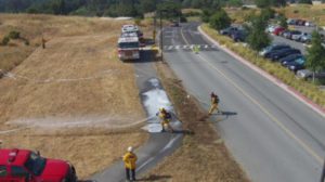
6. Disaster Management and Emergency Response
LiDAR drone services are critical for disaster management, providing rapid and accurate data on affected areas to support emergency response, damage assessment, and recovery planning.
7. Utilities and Energy Sector
In the utilities sector, LiDAR drones help in inspecting power lines, pipelines, and other infrastructure, ensuring early detection of potential issues and reducing downtime.
8. Archaeology and Cultural Heritage Preservation
LiDAR drone technology is increasingly being used to explore archaeological sites and monitor the preservation of cultural heritage without causing any disturbance to the site.
LiDAR drone services represent a revolutionary approach to data collection and analysis across various sectors, providing high precision, efficiency, and safety. The integration of LiDAR technology with drones allows for comprehensive and cost-effective solutions for topographic mapping, construction projects, environmental monitoring, and more. With the ability to generate high-quality 3D models and point clouds, these services are indispensable for any industry that relies on accurate spatial data. For businesses looking to harness the power of remote sensing and LiDAR data, 1UPDrones provides cutting-edge solutions tailored to meet your specific project needs.
Ready to elevate your data collection and analysis with our LiDAR drone services? Contact 1UPDrones today to learn how we can help optimize your next project.