


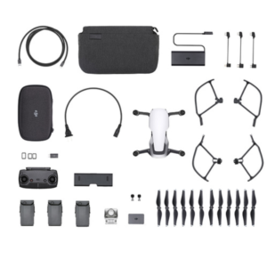
Description
-
The use of Drone and UAV-based platforms in the aerial imaging market is increasing rapidly, and remote sensing is becoming a preferred method for acquiring qualitative aerial data.
Phase One Industrial, a leading provider of aerial imaging solutions, designed a fully integrated and powerful drone solution with DJI M600 and M600 PRO aerial platforms that expands the operational capabilities of our customers. The new drone solution offers an easy and safe aerial access to challenging areas, a larger surface coverage in a single flight, a higher resolution images and an opportunity to acquire aerial data with a cost effective, and efficient tool.
Complete Visibility across Dynamic Environments
Phase One drones solution opens the door to new mission types and applications. Whether for inspection projects or for photogrammetry, map-making and homeland security purposes, the combination of the M600 / M600 PRO and Phase One medium format cameras enable users to offer professional results, higher quality of images, larger coverage of the surface in shorter time – without any risks.

Mapping Solution
Phase One offers a professional, flexible and precision-driven solution that simplifies surveying and mapping processes, and provides professionals with unlimited and ultimate aerial data, while saving time and reducing costs and manpower.
Our medium format metric cameras allows you to effortlessly execute mapping missions, capture high-resolution images and create 2D and 3D maps. It provides invaluable aerial data to industries like 3D Cities, land and resource management, agriculture, mining, forestry and environmental monitoring & research, and more.
Power Line Monitoring
Power line inspection using UAV is taking off as the ultimate solution, as it can cover immense portions of surface in each flight and provide accurate visualization of the power line components as well as surrounding objects.
Phase One UAV solution enables a faster and more accurate collection of visual information, and allows power companies to focus on faultfinding, effective repairing and strategic constructions and maintenance planning, while minimizing the risks to surveying teams.
Wind Turbines Inspection
Wind turbines, often located in remote areas, require millimeter-sized damage spotting in order to detect, react to and repair problems quickly and with minimal influence on the turbine performance or the environment.
Our large area sensors provide a close and detailed look at all turbines parts (including the blades) that can prevent a sudden failure by detecting impending damage and signs of wear in advance and improve maintenance strategies.

Railway Inspection
One of the major problems that railroads have faced since the earliest days is the prevention of failures in track. There is a significant number of potential problems possible and the task of inspecting the thousands of miles of track stretching across the land has to be performed with speed to avoid traffic interference.
We offer a platform that enables predictive maintenance that not only reduces the costs and the risky operations of ground teams, but also increases the speed and precision of data collection.

Roads and Bridges Inspection
Geospatial products allow for more effective planning, construction, and maintenance of infrastructure projects, including roads and bridges. Effective inspection of aging infrastructure and fast identification of fundamental weaknesses (such as concrete delamination) is crucial, since it effects directly the transportation networks and the safety of public users.
Phase One’s platform provides an advance tool for roads and bridges monitoring that helps executing such projects in shorter time, with minimal risk for people or disruption for traffic flow.
Pipeline Inspection
Pipeline infrastructures must be constantly monitored due to the potential threat to lives and economic losses. The Oil & Gas companies’ demand for a reliable and rugged inspection tool is fully addressed by Phase One’s UAV solution, which provides maximum coverage and operational flexibility to operators. It enables fast assessment of the pipes’ condition, precise identification of erosion, exposed pipes, vegetation overgrowth and much more, and helps decision makers with prioritizing maintenance and repair mission.
Reviews
There are no reviews yet.