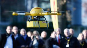
The agriculture market for drones may be the largest true commercial opportunity in the US and the second-largest globally.
The benefits of using a drone on the farm include greater ability to monitor crop health and identify potential problem areas of the field. Ag UAVs are primarily used for monitoring crop health as part of a broader shift toward precision agriculture.
So how does a drone help in precision agriculture and how does the integration work? Precision agriculture involves the latest practices of farming using imaging, testing, and analysis to increase productivity and minimize waste. Drones are the latest iteration of precision agriculture, which historically relied on satellites or airplanes for imaging, but those methods are expensive, dated information, and often unreliable due to cloud cover at the time of surveying.
How precision agriculture is leveraging drones: For as little as .25 cents to .65 cents per acre macro level orthomosaic models can be built to provide crop health and progress reports. Given the sheer volume of land requiring mapping, scouting, and spraying services, we see agriculture as one of the largest markets for Commercial drone use. Many farmers are finding the greatest utility in mapping and crop scouting, a service traditionally provided by local agronomists. Current offerings use UAVs that follow pre-programmed flight paths to develop aerial crop surveys, allowing farmers to identify developing risks and opportunities for yield improvements (e.g., disease, nutrient deficiency, targeted pest pressures, moisture deficits/surpluses).
Drones have many advantages over legacy piloted/satellite surveys, including improved accuracy, frequency, and turnaround time. The latter is particularly important as acute crop pressures vary at different stages in the growing season and can have an exponential impact on yields if undetected. While drones do provide spraying services, we expect this to be a very niche application, as the weight required to support pesticide tanks puts drones over the 55 lb regulatory limit for unmanned flight in the US.
Do you buy your own drone or look to 1UP for a Drone-as-a-service?
Over the next 5 years, we see two models for drones in agriculture. The first would involve farm-level ownership of a drone(s), and the second would see the emergence of companies like 1UP that fly drones as a service for customers. We have you covered in both models! If you own your own at Farm-level ownership: Mapping/scouting services are typically needed only during the summer growing season and are most effective when land is surveyed on a weekly basis which gives you more flexibility to survey your crops as often as needed. Many farmers with large plots of land decide they are better served by purchasing UAVs directly for their farm in order to be able to surveil acreage as often as needed. Alternatively many farmers (especially farms less than 1,700 acres) believe drones are to costly to justify farm-level UAV ownership.


