Revolutionizing Infrastructure Surveying: The Rise of Commercial Drones
Introduction
In the past decade, commercial drones have emerged as a game-changer in the field of infrastructure surveying. From towering buildings and expansive bridges to vast utility networks, these unmanned aerial vehicles (UAVs) are revolutionizing how we assess and monitor critical assets. In this article, we will explore how commercial drone activities are transforming the surveying industry, and the benefits they bring to the assessment of infrastructure, utilities, buildings, and bridges.
Enhanced Efficiency and Speed
Traditional surveying methods often involve manual labor, expensive equipment, and lengthy procedures. Commercial drones have drastically streamlined this process, enabling surveyors to cover large areas quickly and efficiently. Equipped with high-resolution cameras, LiDAR systems, and other advanced sensors, drones capture detailed data from various angles, providing a comprehensive view of the infrastructure in question.
By eliminating the need for human surveyors to traverse rugged terrains or inaccessible areas, drone technology significantly reduces the time required for data collection. The ability to access data remotely allows surveyors to initiate immediate analysis, making the decision-making process faster and more informed.
Increased Safety and Risk Mitigation
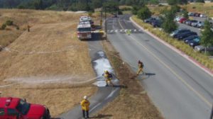
Infrastructure surveying often involves working in hazardous environments, such as inspecting bridges, power lines, and high-rise buildings. By employing commercial drones, companies can mitigate risks to human surveyors and personnel. Drones can safely fly close to structures or along utility lines without jeopardizing anyone’s safety, minimizing the potential for accidents and injuries.
In addition to improving safety, drones can access hard-to-reach locations, reducing the need for costly specialized equipment like cranes or helicopters. This cost-effectiveness enables organizations to invest more resources into data analysis and infrastructure maintenance.
Precise Data and 3D Mapping
One of the key advantages of utilizing drones for infrastructure surveying is their ability to capture highly accurate data. With advanced GPS and navigation systems, drones can precisely map locations and generate detailed 3D models of buildings, bridges, and utility networks. These intricate models offer valuable insights for maintenance planning, structural assessment, and identifying potential vulnerabilities.
Furthermore, drones equipped with LiDAR technology can penetrate dense vegetation or hard-to-reach areas to uncover hidden issues that might be invisible from the ground. The combination of high-resolution imagery and LiDAR data ensures comprehensive and reliable information for engineers and decision-makers.
Cost-Effectiveness and Environmental Benefits
Commercial drone operations are cost-effective compared to traditional surveying methods. They require fewer resources and labor, making them an attractive choice for businesses looking to optimize their budgets. The significant reduction in human involvement and the enhanced efficiency of data collection lead to substantial cost savings in the long run.
Additionally, using drones for infrastructure surveying can have positive environmental impacts. By minimizing the need for on-site personnel and utilizing electric-powered drones, the carbon footprint associated with surveying activities is significantly reduced.
Conclusion
Commercial drones are transforming the way we survey and monitor critical infrastructure, utilities, buildings, and bridges. With their efficiency, safety advantages, precise data collection, and cost-effectiveness, drones have become an indispensable tool for engineers and surveyors. As the technology continues to advance, we can expect even greater improvements in accuracy and data analysis, contributing to the maintenance and longevity of our vital infrastructure systems. Embracing this technology will not only revolutionize the surveying industry but also pave the way for a more sustainable and resilient future.